Description
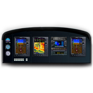
All the capabilities you want in a true “glass cockpit” are brought together in the G3X flight display system — with single display systems designed specifically for experimental/kitplane and light sport panels, this scalable system lets you grow as your needs and budget allow.
The versatile G3X panel-mount glass displays work like building blocks, allowing you to grow your system to fit your needs and budget. You can start with a single display that combines full primary flight (PFD) attitude/directional guidance with electronic engine monitoring and moving-map multifunction (MFD) capabilities.
The multi-tasking Garmin displays that comprise your G3X suite are scaled to fit the panels (and price ranges) of most experimental/kitbuilt and light sport aircraft.
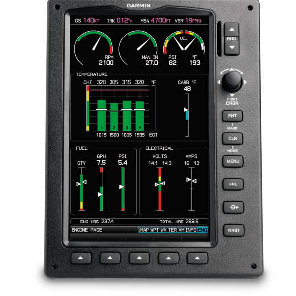
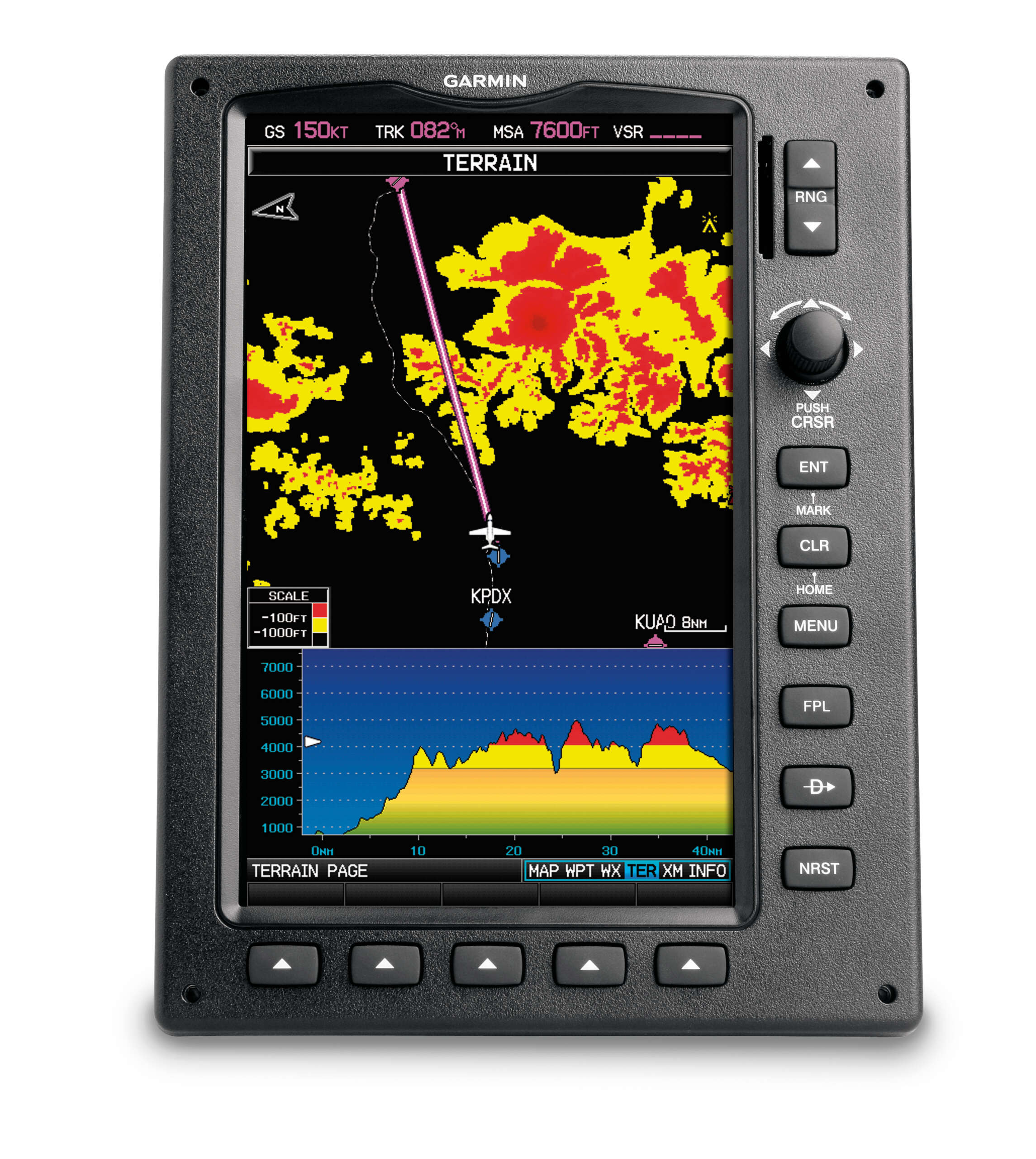
Each display features a big 7″ high-resolution WVGA screen, built-in high-sensitivity WAAS GPS receiver, rotary joystick cursor control for data entry, redundant power inputs, and soft keys for mode selection. There’s a front-loading SD™ card slot for easy updating of software and databases. Plus, a built-in aviation basemap helps provide realistic visual reference — identifying cities, roads, rivers, lakes and other guide points. You can choose topographic VFR or airway-style IFR map modes. And there’s also a built-in terrain elevation database that uses color-coding to alert you as you approach potentially hazardous terrain. Both overhead and vertical profile views of this data are graphically depicted on the terrain page.